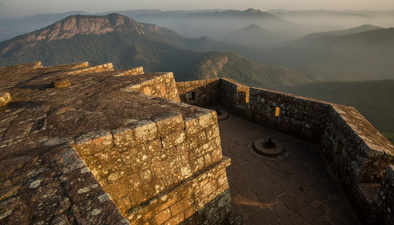
Manjarabad Fort sits on a hilltop just outside Sakleshpur, a few minutes off NH75, the Bengaluru to Mangaluru highway. Tipu Sultan built it in 1792 as an eight-pointed star in granite and named it for the fog that filled the valley while it went up. Thousands of drivers pass the turn-off without knowing what is at the top of the steps, and the pages that do cover it disagree on the history, the distance and even the closing time. Here is the sourced version, with the climb and the parking explained.
The short answer
Manjarabad Fort is an eight-pointed star fort built by Tipu Sultan in 1792, on a hill at 988 m (3,241 ft) in Sakleshpur taluk, Hassan district, about 4 to 6 km from Sakleshpur town beside NH75. Vehicles stop at the roadside and the last stretch is a climb of roughly 250 steps. Karnataka Tourism lists the fort as open 8 am to 6 pm with no entry fee, and it is protected by the Archaeological Survey of India.
In this guide
What is Manjarabad Fort
Manjarabad Fort is an eight-pointed star fort built in 1792 by Tipu Sultan, the ruler of Mysore. It stands on a hill at 988 m in Sakleshpur taluk, Hassan district, Karnataka, and is protected by the Archaeological Survey of India.
The shape is the whole point of the place. Seen from above, the outer wall makes eight sharp points around a hollow centre, a plan borrowed from the French star forts made popular by Sébastien Le Prestre de Vauban. Angled walls deflect cannon fire instead of taking it square on, and every bastion can be covered by guns from the bastions beside it. An attacker has nowhere to shelter. There are no dead corners.
The outer walls are granite laid with lime mortar. Inside them the buildings are fired brick: barracks, an armoury and store rooms, with two cool underground cellars for the gunpowder. The fort today is described as partially restored and open to the public.
Star forts of this kind are rare in India, and the rarity is most of the draw. Rare is not unique, though. Fort William in Kolkata also follows a star plan, so the “India’s only star fort” line on other pages is marketing rather than record. What makes this one worth a stop is the combination: a complete eight-point plan, intact granite walls, and a Western Ghats hilltop you can walk in twenty minutes. The question that follows is why a ruler sitting in Srirangapatna wanted a gun platform on this particular hill.
Who built Manjarabad Fort, and why here
Tipu Sultan built Manjarabad Fort in 1792 to hold the road from the port of Mangaluru up through the Ghats to Coorg and his capital at Srirangapatna. It was a frontier and supply post, not the site of a famous battle.
The hill was not empty before him. Local rulers called palegars held this country from Maninagapura, now Aigur, until Sivappa Nayaka of Ikkeri annexed the region in the mid-17th century. The country later came under Mysore, and Tipu Sultan put the fort on the ridge in 1792.
The timing explains the design. Tipu was in conflict with the East India Company, which had the Marathas and the Nizam of Hyderabad on its side, and he was allied with France. Through that alliance he could ask for French military engineers, which is how a Vauban-style plan ended up on a Malnad hilltop. No source names the engineer who drew it, so any page that gives you a name is guessing.
Geography did the rest. Goods and troops moving inland from Mangaluru had to climb the Ghats, and this ridge looks straight down on that road. A garrison here could see movement long before it arrived, and could keep powder and stores well above the valley floor.
Why is it called Manjarabad
Karnataka Tourism traces the name to the Kannada word “manju”, meaning fog or mist, and local accounts say Tipu named the place after seeing the hill wrapped in fog during construction. That is the version the state tourism department and the history writing on the fort both carry.
There is another reading. One reference suggests “Manjara” as a Persian form of “manzar”, meaning scene or view, which would make the name a comment on the panorama rather than on the weather. Both are in print. The mist explanation is the one the official source gives, and anyone who arrives in July will find it persuasive. Inside the walls, that same mist decides how much of the fort you actually get to see, because nothing on site tells you what you are looking at.
What can you see inside Manjarabad Fort
Inside the granite star walls you will find a cross-shaped rainwater tank at the centre, two cool underground gunpowder cellars beside a deep well, brick barracks and stores, arched guard cells, and a parapet with cannon mounts and musket holes.
Visitors report that there are no information boards anywhere on site, so here is the walk.
The cross-shaped tank is the first thing you see from the gate, set at the geometric centre of the star with steps leading down on all four sides. It collected rainwater for the garrison. Beside it a deep well sits next to the two underground cellars, which stay cool right through the afternoon. Those held the gunpowder, which is exactly where you would want it on a hot hilltop.
Walk the wall and you pass arched guard cells on the north and north-west faces, then the parapet, where the mounts for cannon and the narrow musket holes are still readable. Each of the eight points pushes out far enough to see along the two walls beside it. Stand in one and the geometry stops being an abstraction. A moat runs outside the wall.
The views are the other half of the visit. On a clear morning you look out over the valleys and the ridgelines of the Western Ghats. Karnataka Tourism says the Arabian Sea can be seen on a very clear day. That is the tourism department’s claim rather than a promise, and most visitors get hills and mist instead.
The tunnel: Enough people search for this that it needs saying plainly. The tunnel said to run from the fort to Srirangapatna is local belief, not record. It has never been explored or documented, and the accounts that mention it describe it as folklore. Treat it as a good story told on the steps. What you can actually go down into are the two gunpowder cellars, which are real and open. Getting to those steps is where most trip planning goes wrong, because the fort is invisible from the road that passes it.
How do you reach Manjarabad Fort from Sakleshpur, Hassan and Bengaluru
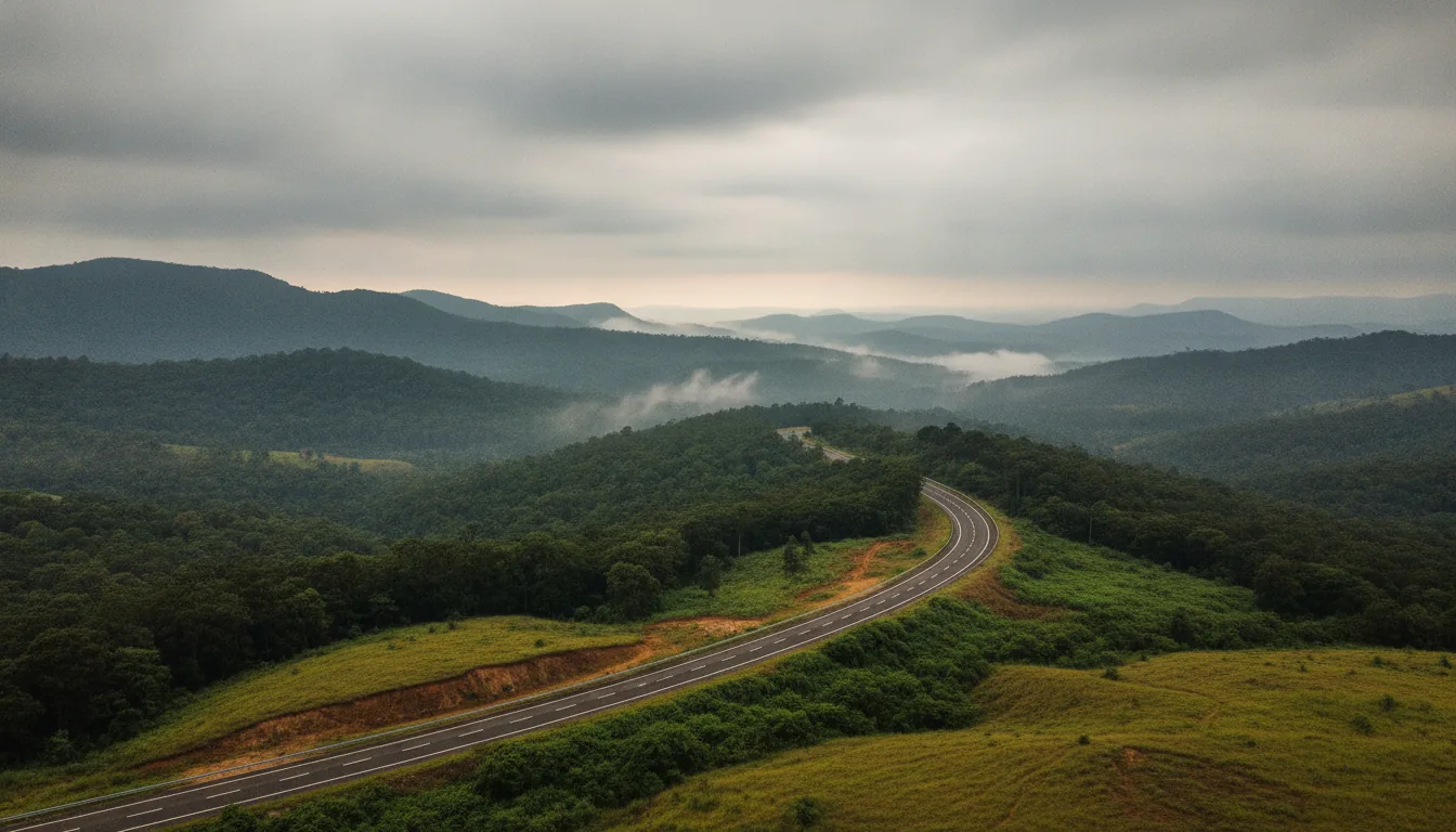
By road. The fort sits beside NH75 about 4 to 6 km from Sakleshpur town, roughly 37 to 40 km from Hassan and about 220 km from Bengaluru. Vehicles stop below the hill and the last stretch is on foot.
- The highway number: Older blogs send you down NH48. It is the same road. The Bengaluru to Mangaluru highway was renumbered NH75 in 2010, and it runs through Sakleshpur and Hassan and on west through the Shiradi ghat. If your directions say NH48 and the signboards say NH75, nothing is wrong.
- The distances: Published figures for the fort from Sakleshpur town run from about 4 km to 6.4 km depending on where the measurement starts, so plan for about 4 to 6 km and a ten-minute drive. Sakleshpur town is about 37 km from Hassan city, and Karnataka Tourism puts the fort about 40 km from Hassan. From Bengaluru, Sakleshpur is about 220 km. The fort is on the Mangaluru side of town, so anyone driving in from Bengaluru passes through Sakleshpur first. The town itself sits on the right bank of the Hemavathi river.
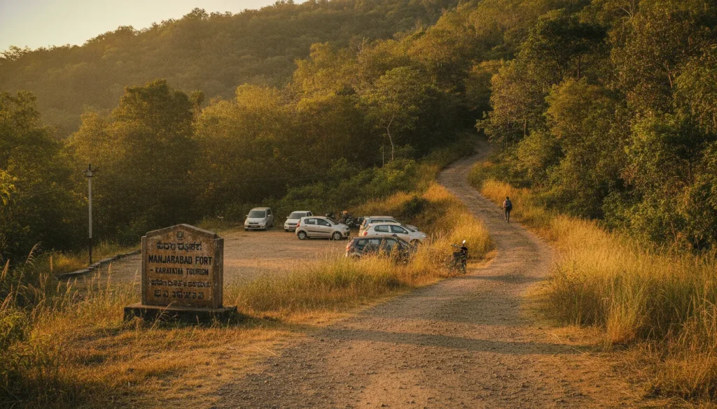
- The turn-off: This is the part that catches people out. The fort is not visible from the highway, the roadside signboard is easy to miss at speed, and there is no landmark to cue you. Set Google Maps to “Manjarabad Fort” before you leave town and watch the distance count down instead of looking for the fort.
- Parking and the climb: Vehicles cannot go up. You stop at the roadside about 200 m short of the fort, where there are a few shops, and walk from there. Parking is roadside and limited, and visitors report it getting disorganised on busy weekends, so an early arrival helps twice over. The climb is about 250 steps: one travel guide counts 253, and visitor reviews put it between 200 and 250. The tourism department has laid a concrete path with railings over most of it, but it is a steady uphill with no shade, and visitors report it being hard going for small children and older members of the family. Carry water, because there are no restrooms and few facilities at the top.
- Rail and air: Mangaluru airport, about 150 km away, is closer than Bengaluru’s, and Hassan is connected by both road and rail. Sakleshpur also has its own railway station on the Bengaluru to Mangaluru line, so you can get off there rather than at Hassan. From the station the fort is a short auto or taxi ride along the highway.
Road and ghat conditions on this stretch change with the season and with repair work, so check a live source on the day rather than any page, including this one. Timings are the other thing worth settling before you set off, because the sources do not agree.
What are Manjarabad Fort’s timings and entry fee
Karnataka Tourism lists Manjarabad Fort as open 8 am to 6 pm with no entry fee. Some travel sites give a 5 pm closing instead, so the safe plan is to arrive well before late afternoon.
There is no ticket counter and nothing to pay at the gate. Entry is free on the official listing, and every source agrees on that much.
Closing time is where they split.
| Source | Opening hours listed |
| Karnataka Tourism (official) | 8 am to 6 pm |
| MakeMyTrip | 8 am to 6 pm |
| Tour-operator and review pages | 8 am to 5 pm |
Nobody on site is going to referee that for you, so treat 5 pm as the real deadline and leave yourself an hour above it. The light is better earlier anyway.
This is a Monument of National Importance protected by the Archaeological Survey of India, which lists it as the “Fort and Dungeons” at Manjarabad. The usual protected-monument rules apply: nothing damaged, nothing removed, nothing written on the walls. Visitors report no restrooms and few facilities, so plan for that before you start the climb. Season changes the experience here more than at most forts, because the thing the fort is named for only turns up for part of the year.
When is the best time to visit Manjarabad Fort
Karnataka Tourism recommends winter and the post-monsoon months, when mornings are often misty and the views stay clear. Many visitors come during the rains for the thicker fog, though the views are less predictable then.
The trade-off is simple. Post-monsoon and winter give you green hills, settled weather and the best odds of a long view from the parapet. The monsoon gives you the full fog that named the place, plus slick steps, low cloud where the panorama should be, and a wetter walk.
Plenty of visitors still come in June, July and August for that fog, even though the photographs are usually better in winter.
Mornings beat afternoons in any season. Haze builds through the day, the climb is cooler early, and an early start keeps you clear of the closing-time confusion entirely. Once you have picked the season, the last planning question is how long to block out for the stop.
How much time do you need at Manjarabad Fort
Plan one to two hours on site. That covers the climb of about 250 steps, a full circuit of the star walls, the central tank and the gunpowder cellars, and time to sit with the view before heading back down.
Thirty to forty minutes is enough if you are only stopping to look: up, one lap, a few photographs, down. One travel guide puts the whole trip at about an hour. Visitors who take their time report one to two hours, and that is the version worth planning for, because the walls repay a second circuit once you have worked out the geometry.
As a highway stop it fits neatly. An early start from Bengaluru puts you at the fort by late morning with the day still open for Sakleshpur town, and drivers heading west can take it as a leg-stretch before the Shiradi ghat. The hills you look at from the parapet are not wilderness, though. They are working estates, and they carry the fort’s name.
Why is this corner of Sakleshpur called coffee country
The name Manjarabad outlived the fort. Hassan district was part of the Manjarabad Faujdari between 1832 and 1881, planters founded the Munzerabad Club in Sakleshpur in 1893, and Hassan still ranks third in Karnataka for coffee production.
Under British administration the territory around this hill was run as the Manjarabad Faujdari from 1832 to 1881, which is how an eighteenth-century fort’s name became the label for a whole stretch of the Malnad. The planters who followed kept the spelling they inherited. The Munzerabad Club, founded in Sakleshpur in 1893, still carries it, and the planting families recorded around it include the Middletons of Kadamane Estate, the Crawfords and the Radcliffes. Belur-Sakleshpur coffee country has gone by that name for well over a century.
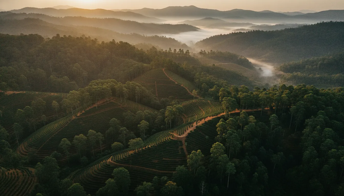
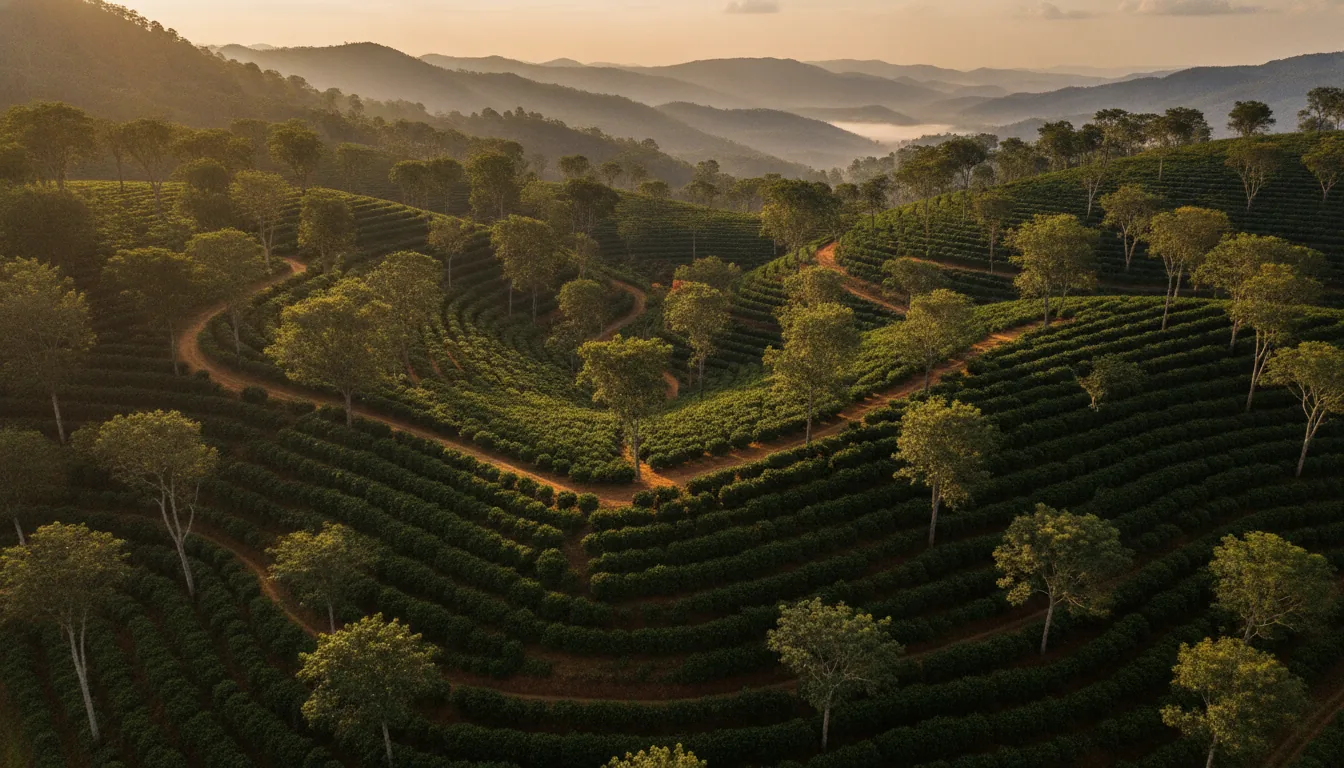
The economy has not moved far from it either. Coffee and black pepper are still the district’s main crops, Sakleshpur taluk still runs on plantation agriculture, eco-tourism and the spice trade, and Hassan ranks third among Karnataka’s coffee-producing districts. The ridges you see from the parapet are shade-grown coffee, pepper vines on silver oak and timber, which is why the coffee estates in Sakleshpur start more or less where the steps end.
Sakleshpur is one of several taluks in the district built on the crop, and the others are covered in our guide to Hassan district’s coffee taluks. If you are trying to place this belt against the better-known names, our piece on how the three coffee belts compare sets Sakleshpur beside Coorg and Chikmagalur.
The fort is also a good starting point for the rest of the district.
What other places can you visit near Manjarabad Fort
Pair the fort with Sakleshwara temple in Sakleshpur town, the Bettada Byraveshwara temple about 35 km away, the Bisle Ghat viewpoint about 42 km away, and the Hoysala temples at Belur and Halebidu further east.
- Sakleshwara temple, Sakleshpur town: The Shiva temple the town takes its name from, close to the highway and an easy add-on either side of the fort.
- Bettada Byraveshwara temple: About 35 km from Sakleshpur, a hilltop Shiva temple close to 600 years old, per Karnataka Tourism. Also written Betta Byraveshwara.
- Bisle Ghat viewpoint: About 42 km from Sakleshpur, per Karnataka Tourism, on the road south toward Kukke Subramanya.
- Belur and Halebidu: The Hoysala temples lie north-east of Sakleshpur and make a full day of their own rather than an afternoon tacked onto the fort.
- Treks: Jenukal Gudda, the highest point in Hassan district, and Agni Gudda are the best-known hill walks in the taluk. Both are best done between October and May, and it is worth asking locally about forest permits before you set out.
One correction worth making before you plan the day. Karnataka Tourism’s own page for the fort lists “Abbey Falls” as nearby. That is not the well-known Abbey Falls in Kodagu, which is a long drive south of here. Around Sakleshpur the name points to the local Abbi falls, such as Manjehalli Falls, so check the pin before you drive.
For everything else in the taluk and how to order a weekend around it, our Sakleshpur sightseeing guide covers the ground properly.
Frequently asked questions
Is Manjarabad Fort worth visiting?
Yes, if you like history you can walk through and do not mind a climb. You get a complete eight-pointed star fort from 1792, granite walls you can circuit, underground gunpowder cellars and long Western Ghats views. Entry is free, the visit takes one to two hours, and it sits right on the Bengaluru to Mangaluru highway. Visitor ratings run in the high threes to low fours out of five.
How many steps are there to Manjarabad Fort?
About 250. One travel guide counts 253 and visitor reviews put it between 200 and 250. Vehicles stop roughly 200 m below the fort, and the tourism department has laid a concrete path with railings over most of the climb. Visitors report it being hard going for small children and older members of the family, with no shade on the way up.
Is there any entry fee for Manjarabad Fort?
No. Karnataka Tourism lists the fort as free to enter, open 8 am to 6 pm, and there is no ticket counter on site. It is a Monument of National Importance protected by the Archaeological Survey of India, so normal protected-site rules apply. Visitors report no restrooms and few facilities at the top, so carry water.
What is the distance between Hassan and Manjarabad Fort?
About 37 to 40 km. Sakleshpur town is roughly 37 km from Hassan city, and Karnataka Tourism puts the fort about 40 km from Hassan. The drive is on NH75, the Bengaluru to Mangaluru highway, and the fort lies just past Sakleshpur on the Mangaluru side, so allow about an hour including the turn-off.
Is there a tunnel in Manjarabad Fort?
No documented tunnel exists. A tunnel said to run from the fort to Srirangapatna is local belief, repeated in travel writing and described there as folklore. It has never been explored or recorded. What you can go down into are the two underground gunpowder cellars beside the well, which are real and open to visitors.
Coffee country you can own – Euphora, a half-acre of managed coffee estate in the Belur-Sakleshpur belt
The hills you look down on from the fort’s parapet are working coffee, pepper and timber country. Acres Community’s managed estates let you own a half-acre of managed coffee estate in that belt, registered in your own name with your own land record, while the farming and crop care, security, roads, fencing and water, and a dedicated relationship manager are handled for you. Euphora in the Belur-Sakleshpur belt is the live project. See our page on land for sale in Sakleshpur, or read why people are owning coffee country, not just visiting it, and what an owner’s weekend in Sakleshpur actually looks like. Enquire for current pricing.
While the world visits, you belong.